Legend Tool
|
The Legend Tool enables you to view symbols that represent attributes on the map, such as Boundaries and Transportation. |
|
 Legend Tool
The Legend tool is accessed by clicking on the Legend icon on the vertical panel to the left of the Public Web Map display window. (Figure.1)
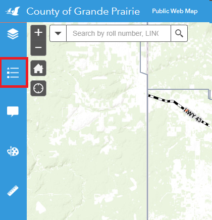
Figure. 1
Open the Legend Tool – click on the ![]() icon on the Tool Bar.
icon on the Tool Bar.
Symbols appearing on the map, as well as attributes they correspond to, are displayed on the Legend section, as shown in Figure.1.
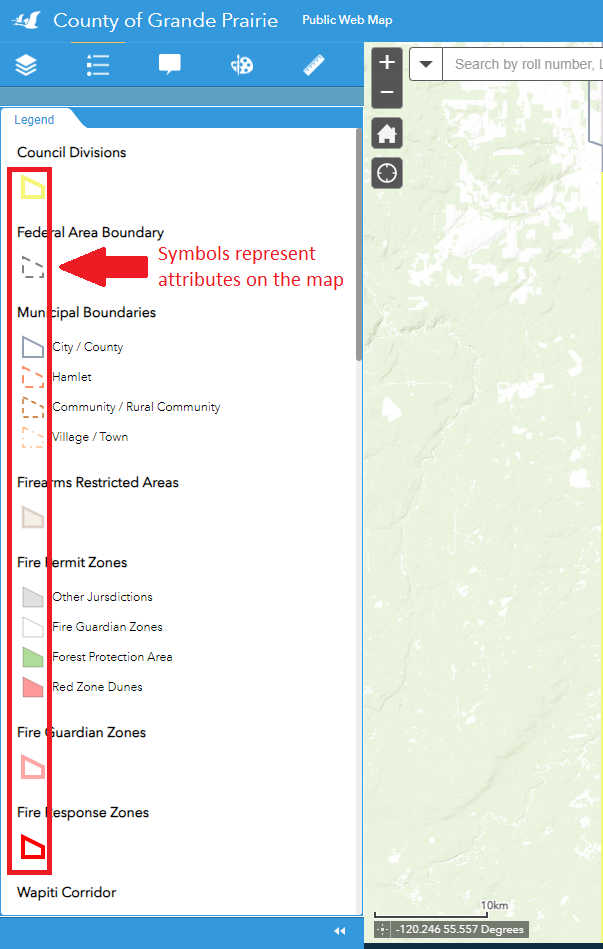
Figure.1
Notes
![]()
- More details will appear on the Legend section after zooming in.
- The legend will only show up for active layers. See instructions on Layer Tools for how to turn layers on and off.
Created with the Personal Edition of HelpNDoc: Experience the power of a responsive website for your documentation