Getting Started
|
Welcome to the Getting Started Guide for the County of Grande Prairie's Public Web Map. This page will walk you through the elements of the Web Map by showing the main page and tools available to you when you start using the Web Map. Each tool and component is explained in more detail in its own help page accessible by using the left pane of this Help application. |
Familiarize yourself with the Main Page
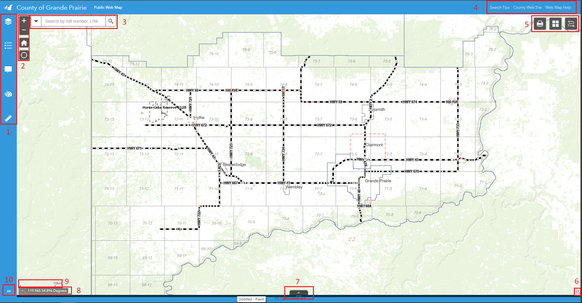
Figure.1
- Vertical Tool Bar
Located at the top left corner of the map, this tool bar contains Legend, Layers, Measurement, PopUp Panel and Draw tools, as shown in Figure.2. For more information about each tool, check out the "Tools" section of the help guide.
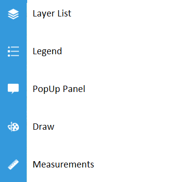
Figure.2
- Navigation Bar
The Navigation Bar located right next to the Tool Bar at the top left corner. It contains Zoom In, Zoom Out, Home button and Find Current Location button, as shown in Figure.3.
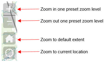
Figure.3
- Search Bar
The Search Bar/Find Tool is located right next to the Navigation Bar. This tool enables the users to search the map by roll number, LINC, address, plan block lot, place name or LSD/ATS Grid, as shown in Figure.4. Note that in certain maps (e.g., The internal staff Assessment Map), the search bar maybe be configured to search for other pieces of information that are important to the purpose of the map.
![]()
Figure.4
- Help Links
There are two useful links at the top right corner of the main window. The first is linked to a PDF with tips for using the search Bar, next is linked to the County’s Web Site, the last one is link to the Public Web Map Help File, as shown in Figure.5.

Figure.5
- Horizontal Tool Bar
There three other tools right below the Help Links at the top right corner, as shown in Figure.6. Note that tools available in this area may change based on the contents and purpose of the map.
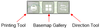
Figure.6
- Tiny Arrow
The Tiny Arrow is a link which will open the Overview Map. By default, the overview map is hidden. Users can click on the arrow locating at the bottom right corner to hide/show the overview map. The overview map shows the extent of the entire map the user is currently viewing.
![]()
Figure.7
- Maximize Attribute Table
Clicking on the arrow shown in Figure 8 will Maximize the attribute Table. For more information on the Attribute table click the link Here to visit the Attribute Table Tool section.
![]()
Figure.8
- Coordinates Tool
The coordinate Tool will display the world coordinates of the location of the mouse on the map. By clicking the icon to the left of the coordinates on the tool, you can drop a pin on the map for a set of fixed coordinates.
![]()
Figure.9
- Scale Bar
The scale bar found in the bottom left of the map will display a reference distance that will automatically adjust based on the zoom level.
![]()
Figure.10
- Maximize/Minimize Tool Details
Click this arrow to view details of a tool in the Vertical Tool Bar, or to hide the details of a tool in the Vertical Tool Bar.

Figure.11
Created with the Personal Edition of HelpNDoc: Maximize Your Productivity with a Help Authoring Tool