Layers List Tool: add/remove map layers

![]()
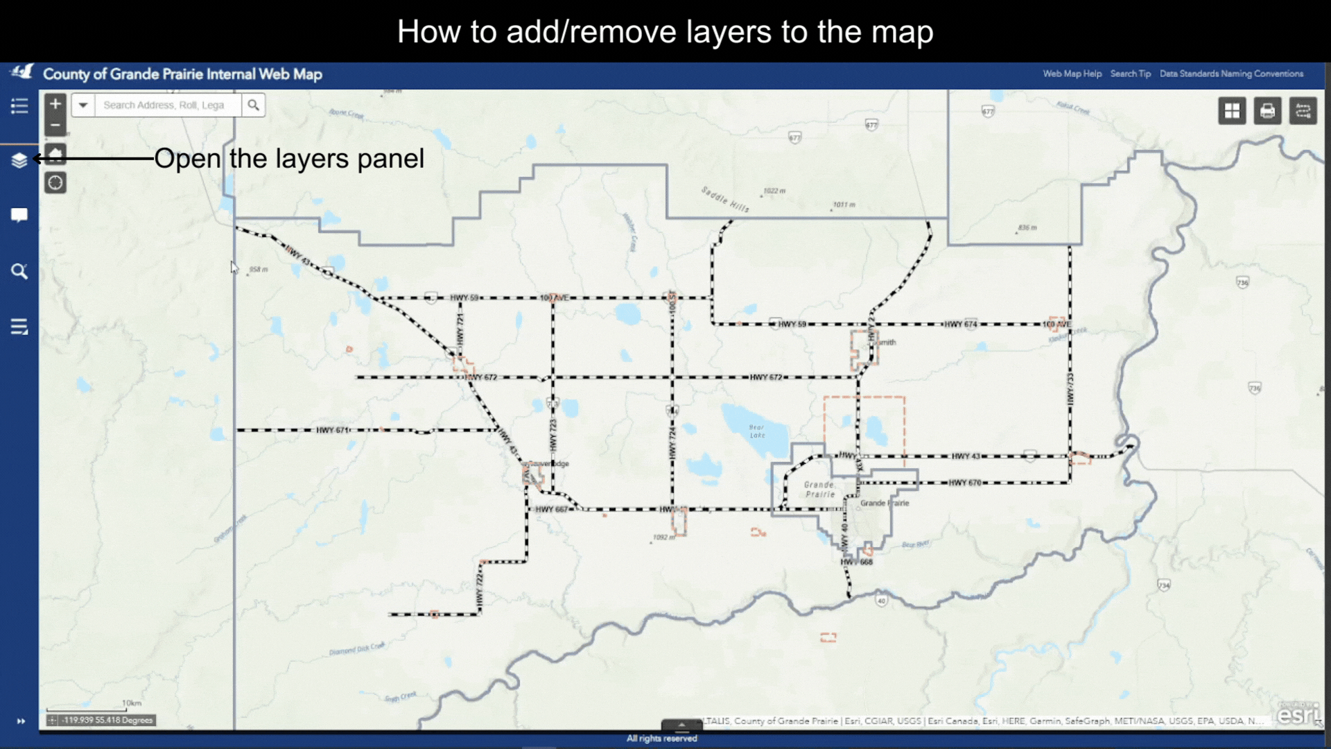
Open the Layers Tool – click on the ![]() icon on the Tool Bar. A list of Operational Layers available in the map will show up on the Layers section.
icon on the Tool Bar. A list of Operational Layers available in the map will show up on the Layers section.
Note that these Operational Layers are basically Layer Categories. A Layer Categories is a theme such as Transportation or a County Department such as Fire Services. A single Layer Category contains one or more map layers.
Turn On/Off a layer
![]()
For each layer, there is a checkbox controlling the layer’s visibility, as shown in Figure.1. Turn on/off a layer by checking/unchecking the checkbox.
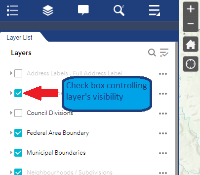
Figure.1
Layers under a Layer Category
![]()
- All layers on the Operational Layers list are essentially Layer Categories.
- There are sub-layers under each Layer Category.
View layers under a Layer Category
![]()
- Click on the expand arrow for a certain Layer Category, as shown in Figure.2.
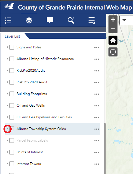
Figure.2
- For each single layer, there is also a checkbox controlling its visibility. Turn on/off this layer by checking/unchecking the checkbox, as shown in Figure.3.
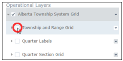
Figure.3
Created with the Personal Edition of HelpNDoc: Quickly and Easily Convert Your Word Document to an ePub or Kindle eBook