View Additional Layers
|
The Public Web Map uses map layers to control what details you can see or cannot see on the map. By using the Layer List Tool you can customize what details to make visible on the map. For example, if you do not need Provincial Roads or Address Labels on your map, you can use this tool to turn the Provincial Roads and Address Labels off. For example you can turn provincial roads on or off, or lakes and streams depending on what you wish the map to convey. For more information on the Layer List Tool, click here. |
|
Layers Tool
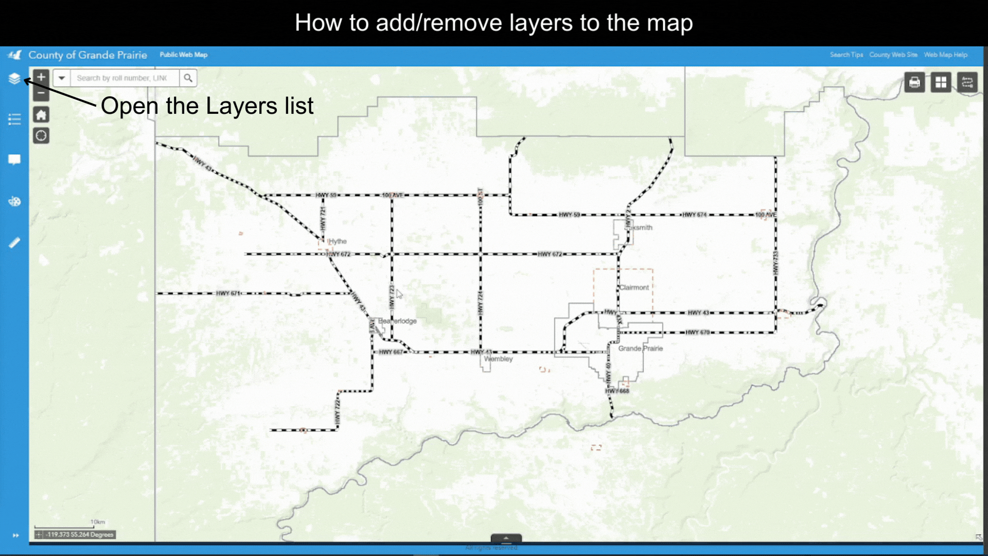
- Open the Layers Tool - click on the icon on the horizontal tool bar on the left of the Web Map display window. A list of Layers available in the map will show up on the Layers section. These Layers are basically Layer Categories. A Layer Categories is a theme such as Transportation or a County Department such as Fire Services. A single Layer Category contains one or more map layers.
Figure.1
- Turn On/Off a layer - For each layer there is a checkbox which controls the visibility of the layer. Make a layer visible by checking the check box, and make a layer invisible by unchecking the checkbox.
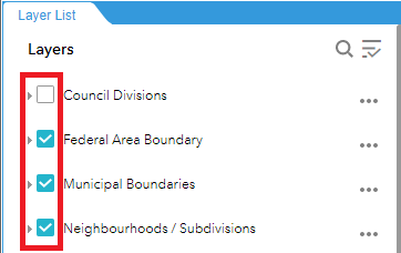
Figure.2
Additional Operations You Can Perform on a Layer
Click on the ![]() symbol to the left of an Layer. A dropdown list will show up with additional operations that you can perform on a layer, described below
symbol to the left of an Layer. A dropdown list will show up with additional operations that you can perform on a layer, described below
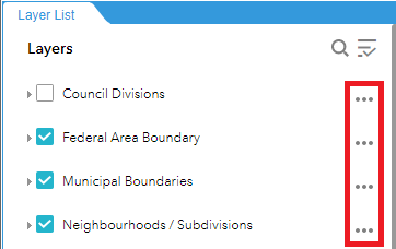
Figure.3
- Zoom to this layer - On the dropdown list, click on Zoom to. The map will zoom to this layer.
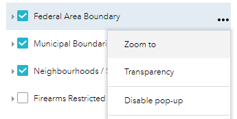
Figure.4
- Make a layer transparent - On the dropdown list, click on Transparency. Drag the thumb on the progress bar to change the layer’s transparency.
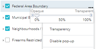
Figure.5
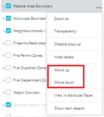
- Move a layer up or down on the Layers list - Click on Move up to move the layer one position up on the list,or click on Move down to move the layer one position down on the list.
Created with the Personal Edition of HelpNDoc: Free Kindle producer