Get an Area or Distance Measurement
|
The Web Map allows you to use the Measurement Tool to use points, lines, and shapes to measure distances and areas. Use the Measurement Tool to answer questions such as, how big is that parcel or building? What is the distance between two parcels? For more information on the Measurement Tool, click here. Learn how to make an Area Measurement, a Line Measurement, and a Point Measurement. |
|
Measurement Tool
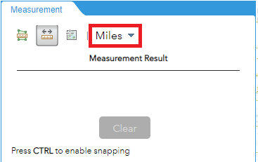
- Click on the ruler icon on the horizontal tool bar. This is the Measurement tool. Choose to either measure a distance, an area, or a location.
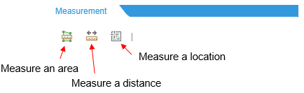
Measure Area
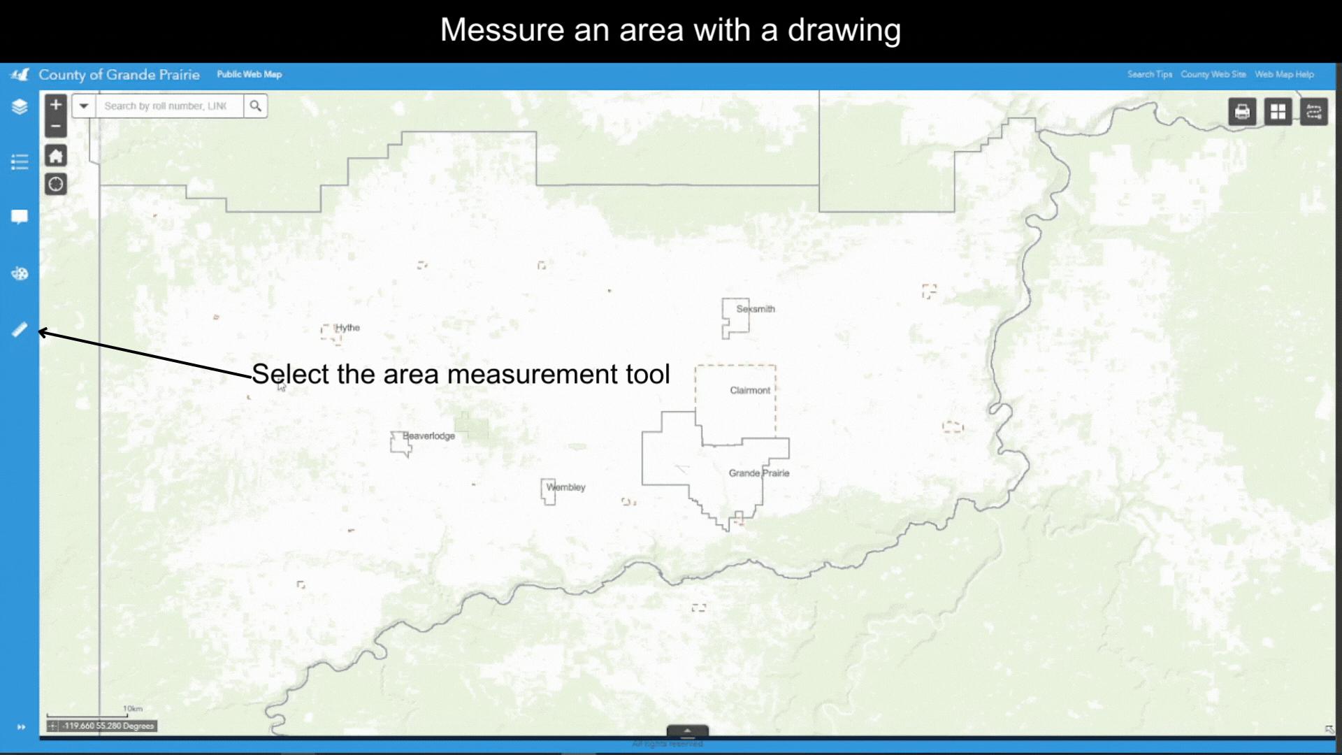
- Click on the
 icon to open the Area Measurement Tool.
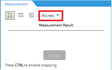
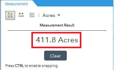
- By default, the unit for measurement is Acres. You can select a different unit from the dropdown list.
- Single click on the map to draw the vertices of the shape. Then double click on the last vertex to finish the drawing.
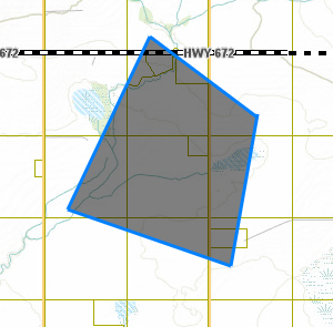
- Area of shaded region will show up under Measurement Result
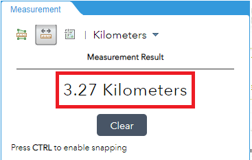
Measure Distance
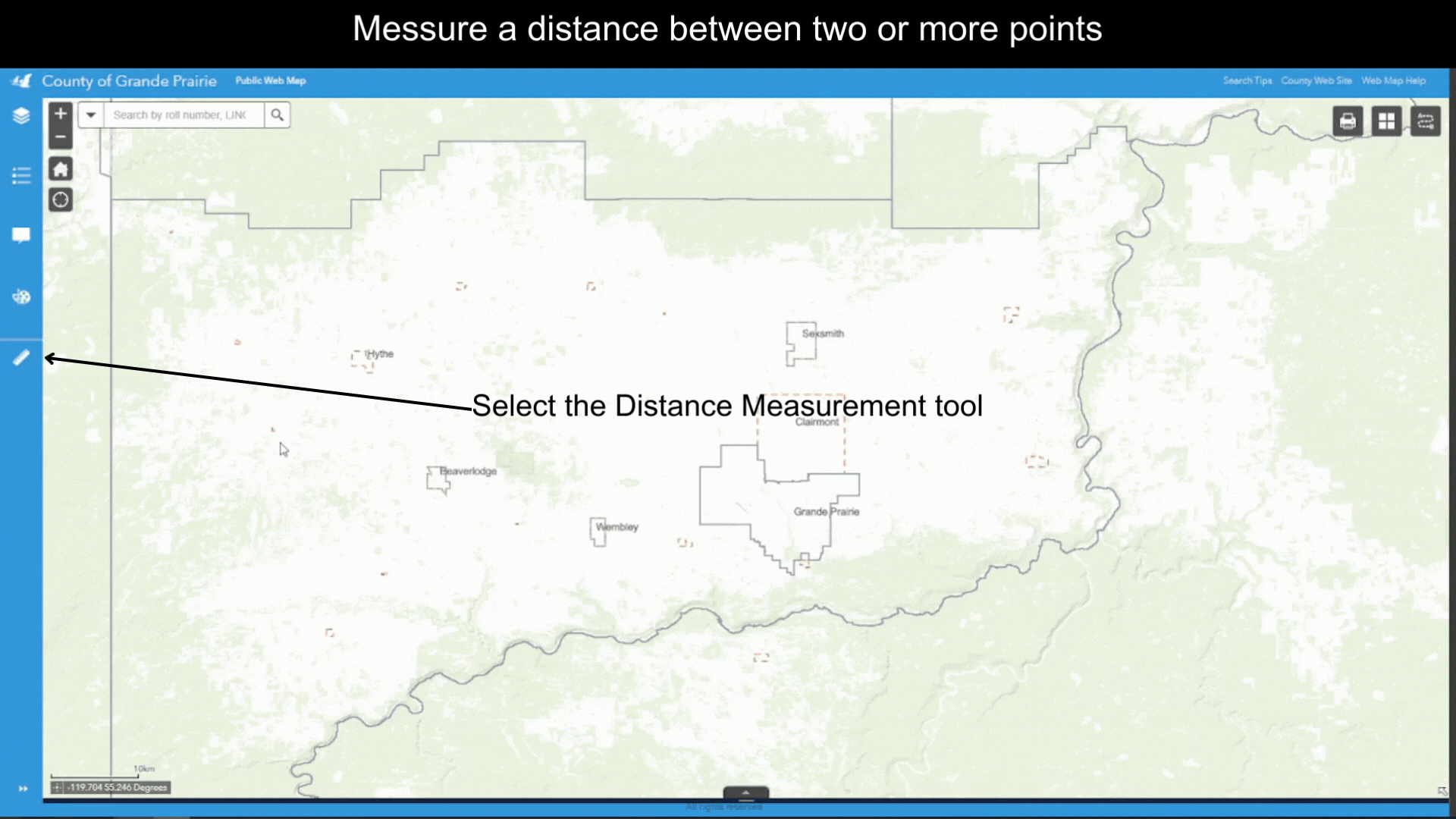
- Click on the
 icon to open the Line Measurement Tool.
 - By default, the unit for measurement is Miles. You can select a different unit from the dropdown list.
- Single click on the map to start drawing. Single click on the map to draw the vertices, Double click on the last point to finish drawing.
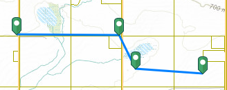
- Length of lines will show up under Measurement Result.
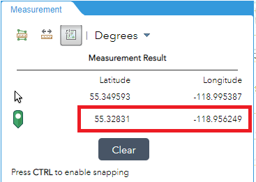
Measure Location
- Click on the
 icon to open the Point Measurement Tool.
 - By default, the unit for measurement is Degrees. You can select a different unit from the dropdown list.
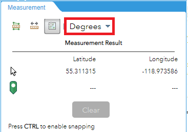
- Single click on the map to place a marker. The coordinates will show up under Measurement Result, to the right of the
 symbol.
Created with the Personal Edition of HelpNDoc: Free help authoring environment