Mail Merge Tool

![]()
|
The Internal Web Map has to ability to select the address of a specified area and then export the addresses to a a CSV file. By using the Measurement Tool you can define the area which has the addresses in which you are interested. This operation is referred to as 'Mail Merge' and can be used to make labels or letters, perform data processing, etc. |
|
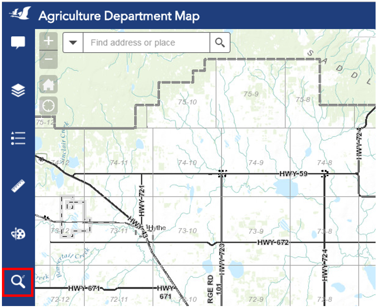
1. Select the Mail Merge Widget, which is the magnifying glass symbol on the left side of the screen.
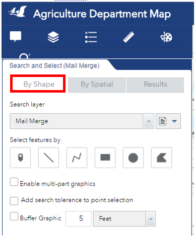
2. Click the ‘By Shape’ tab to view the options available to select the map features. Select feature by ‘Point’ ![]() , ‘Line’
, ‘Line’ ![]() ‘Polyline’
‘Polyline’ ![]() ‘Rectangle’
‘Rectangle’ ![]() ‘Circle’
‘Circle’ ![]() or ‘Polygon’
or ‘Polygon’ ![]() .
.
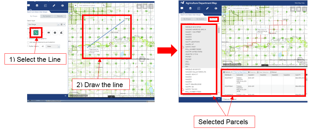
3. After you draw the shape the search will run. The parcels which are selected are generated as a list format in the ‘Results’ tab, and in table format underneath the map display.
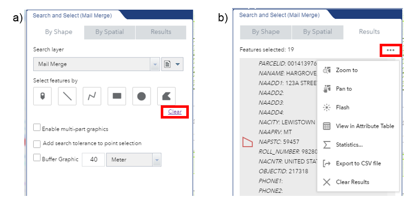
4. To run a new search, either a) in the ‘By Shape’ tab, click the ‘Clear’ link, or b) in the ‘Results’ tab, click the ![]() symbol and select ‘Clear Results’ in the drop down menu.
symbol and select ‘Clear Results’ in the drop down menu.
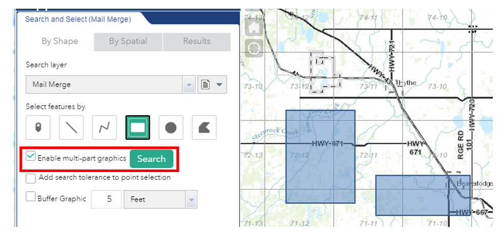
5. If the areas which you want to select are geographically separated and you need to use more than one shape to select all the desired parcels, click the box beside ‘Enable multi-part graphics’. Once all the shapes are drawn, click the ‘Search’ button.
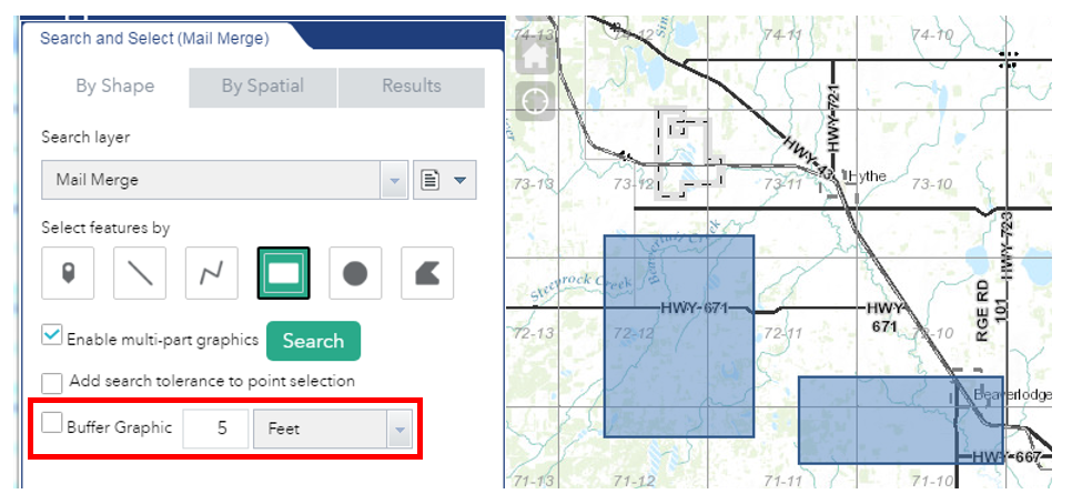
6. If you want to select parcels which are within a specific distance of your selection, click the box beside ‘Buffer Graphic’ and specify the number and the units of the buffer.
Created with the Personal Edition of HelpNDoc: Step-by-Step Guide: How to Turn Your Word Document into an eBook